Duration: 34 days
The first leg of this stage will require an overnight sail to Thomas Bay. To this end we departed Broome around 1400 hours^ on Thursday 6th June, with good winds and current in our favour, we arrived at our destination almost twenty-four hours later. With Cape Leveque and Leveque Islet at its northern end, the wide shallow bay with a large section of stunning ‘iron ore’ ochre cliffs, and a gorgeous beach provided an excellent rest stop. (^NB Leaving later in the day allows us to arrive at unknown destinations in daylight hours so we can spot any uncharted obstacles and anchor in daylight hours).
Next day, at 2100 hours, we upped anchor at Thomas Bay hours bound for The Kimberley. There was little wind, so engines were on, but we did have the tide in our favour which helped us along. Tides and current will become extremely important and together with wind direction and strength will need to be factored into our sailing and stoppage plans as we move throughout this region.
Peter had the 0400-0700 shift; and when Sandra woke up to take over it was to the startling reality that we were in The Kimberley. Bucket List #2 achieved . As we entered Goose Channel, it was Alice in Wonderland-ish, the cliffs were stacked with chalky white boulders, like something from the Flinstone’s. Then we were passing the famous Silica Beach. (We didn’t stop here as we have visited such beaches in Queensland). As we continued to motor along, the cliff appearance changed to what we would usually associate with this region – tall sheer red sandstone with the low tidal mark clearly visible. Vegetated islands and rocky outcrops dotted everywhere, and the sea was bubbling away like a cauldron. At times, wind against tide and opposing current caused Sea Goddess to move forward side on, at about a 45° angle to our heading, which was disconcerting and it took a while to adjust.
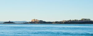
We passed small islets called The Piccaninnies; Galah Channel running between Cockatoo and Irvine Islands, then Parakeet Channel between the north end of Cockatoo and Koolan Islands. (Koolan Island is huge and is currently mined for iron ore).
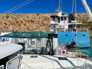
Next was a stop at a 24 hour fuel barge which sits in the middle of a bay. ULP and diesel $4.00 per litre (We’ll never complain about fuel prices again!). While we were there a tanker docked on the starboard side of the barge to refuel the fuel dock! We got chatting to the operator who told us he does two weeks on the barge and two weeks off. He is based in Broome and flies in and out from an airstrip on Cockatoo Island, then via power boat to the barge. Sitting alongside the power boat was a much larger motorboat where barge operators live while they are here. He also had Drumstick ice creams for sale which we couldn’t resist and treated ourselves. After refuelling we made our way to our overnight anchorage at Silver Gull Creek. A gorgeous spot surrounded by a horseshoe of majestic cliffs and sparkling crystal-clear water. As we take it all in, both of us are in awe, feels surreal that we are finally here. Photos below of the Dog Leg Creek Fuel Barge, Sea Goddess in the foreground and the refuelling tanker in the background.
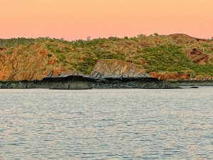
As we prepare to depart for Silver Gull Creek it’s sunrise, a magical time of the day and the effect of sun rays on surrounding cliff face is stunning. The escarpment is ever changing due to weathering, and with low tide the rock outcrops in the water look as though they are sitting on plinths (like a statue). There is no doubt we’re going to run out of superlatives to describe the magnificence of what we are seeing and experiencing here, and its only Day 2.
Traversing ‘The Canal’ between Koolan Island to the west, and the mainland to the east, it wasn’t possible to sail due to the current flow, so we motored. Through our journey in this region, there are times when the current is so intense that our boat literally skates or slides on top of the water, you have no control without assistance from the boat engines. So whoever is at the helm must be ever vigilant for these eddies and/or areas that look like a circular mirror obscuring the current underneath.
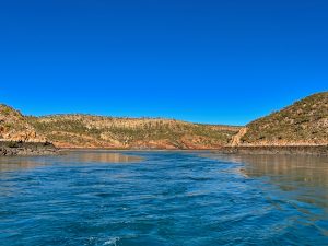
We had the option of going through a gap between Koolan Island and Round Island called ‘The Drain’, even though we only draw 1.25 metres we erred on the side of caution and deemed it too shallow at low tide so we opted for ‘The Gutter’ between Round Island and the mainland. With both engines on we moved through the bubbling water with no problems. This took us into what is known as ‘The Channel’, to the west is the top end of Koolan Island to the east is a craggy group of islands called the Iron Islands. At the end of Koolan Island is a yacht club, Yip sitting high upon the hill. Who would have thought. Honestly, it looks totally out of place up there, and we’re baffled as to where they would get their membership from. The photo below shows ‘The Gutter’.
We continued on, passing a series of islands and islets with contrasting vegetation. Some densely vegetated (like tropical north Queensland or Hawaii), whilst others are basically barren rock with a scattering of spindly pink hued trees here and there. We reached the head of Dugong Bay by late morning and motored across the bay to check out Dugong Falls, unfortunately there was no water flowing. C’est la vie!
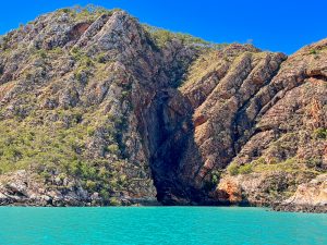
Talbot Bay & Horizontal Falls
We left Dugong Bay the next morning at low tide, tidal markings clearly visible on the cliffs with the underbelly on show demonstrates the significant tidal range in this region. Large mangroves were fully exposed; mud flats reached out from the bottom of craggy structures and cliffs, and rocks which were submerged at high tide were now on full display. As we made our way to Talbot Bay there were lots of small, vegetated islets and striated rock formations dotted along our route. After 4 ½ hours we reached the channel to Talbot Bay, passing Slug Island on our way to the anchorage point. When we got a close-up lateral view of the island it really did look like a slug.
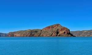
As we exited the channel and entered the bay, we noted two cruise ships anchored – Coral Geographer and Scenic Eclipse II. Just by looking at Scenic Eclipse II you could tell it was high end, beautifully maintained with helicopter and helipad atop and towards the stern. A covered staffed platform at water level was in place to assist passengers to embark and disembark from zodiacs which were operated by crew. Once anchored we took our tender along the cliff line to check the bay entrance to Horizontal Falls. Pegged it right, so we went in as far as the narrow gap between the two rocks faces – this is where all the fun happens. Rapids bubbling away, tide still coming in. Peter suggested we wait until this afternoon for slack tide before we get the engines cranked and cross the gap. (Two tenders, fully loaded with passengers from Scenic Eclipse II were also there checking conditions and opted not go through at this time).
We then headed back out to the bay and continued southeast to cruise along the cliff line taking in the majestic surrounds of the bay. Then turned back to the Horizontal Falls Sea Plane Charters pontoon with hotel style accommodation which sits in the water towards the far end of the bay. Several high-powered ribs docked here (these are the ones that you see on the tourist TV shows and can traverse the Falls at super high speed).
Shortly after we arrived back at the boat we were visited by five WA Parks and Wildlife officers in a small power boat. A female and a male officer came forward to the bow and led the conversation; two remained in the small cabin just observing and one was at the side on a handheld electronic device. Conversation was low key, just the usual questions and getting a feel for who we were and our travel plans. Peter showed them the purchased Dambimangari Aboriginal Corporation visitors pass ($55.00 for one month), which allows access to specific areas of Dambimangari country, including Horizontal Falls. They were surprised that we had it! They chatted to us about being croc aware and not leaving the tender in the water. Told us stories about other boaties using gaffe tape to cover up bite marks, so the stories of rubber dinghies like ours being used as ‘teething rings’ are true! We raise our tender after each use, so the risk is minimal, and just in case we do have gaffe tape on board. They gave us a bag with a number of pamphlets about the region before they left.
Mid afternoon with the tide in our favour we kitted up in our Kimberley Coast Sailing Yacht Club* gear and took the dinghy through the first gap in the cliffs i.e. from Talbot Bay. The second gap is much narrower and where it all happens, Peter checked that I was ready, revved the dinghy engine and with the water madly bubbling and swirling we went through the gap. The dinghy was buffeted from side to side, and swung nose to stern a couple of times, it was exhilarating. (We were so glad we had a good sized engine. Anything less powerful and we would have had difficulty controlling the passage). Once through the gap there are large pools of swirling water, and beyond this is a third gap called ‘The Narrows’. Not only was the gap between cliffs really narrow, the water was speedily swirling (even more so than the one we had just came through) there was also clearly discernible drop in the actual water level at the back end. We didn’t feel comfortable going through or exiting this one, so we turned around and headed back through the second gap again. Much more fun the second time as you knew what to expect and it was easier to fully engage and get that adrenaline rush. Sandra caught all the action on GoPro so it will be great to have our achievement captured to show family and friends, as well as for us in the future.
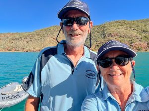
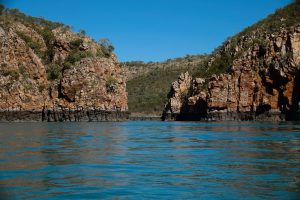
Back to the boat, we celebrated with a glass of wine while we waved to a few zodiacs from Scenic Eclipse II who were headed to the falls for their dose of excitement. The helicopter had been doing a roaring trade all day. As well as sea planes buzzing in and out as well. Both cruise ships left later that day, while we rested up for our onward passage the next day. Peter also organised an Uunguu Visitor Pass which allows us to access several significant sites within The Kimberley, from Careening Bay upwards. Cost of the pass is $100.00 per person and can be purchased from their website http://www.wunambalgambera.org.au
At 0600 hours we upped anchor at Talbot Bay. We’ve noticed that the more north we go the murkier the sea water, probably due to a number of factors including that the water temperature is much higher which promotes a lot more nutrient and growth in the water; the seabed is mud as opposed to sand; the current and tides stir things up as well. So, when we retrieved the anchor and anchor chain both were smothered in gooey mud. Luckily, we have a sea water wash outlet onboard and a dedicated sea water hose, and we used this to wash it off as we retrieved the chain and anchor. Added about 15 – 20 minutes to the process, but is worth it given the reports that any residue mud smells and we want to avoid that in the anchor chain locker.
Motoring along, and once out of the channel, we moved offshore passing lots of islands, islets and rocks. Some of the latter are partially above sea level all the time, others are only visible at low tide. Peter does an amazing job of accounting for these, plus a myriad of other factors including water depth; current; tidal movement; predicted wind direction and force when he is planning our routes.
Melomys Island
After 6 ½ hours we arrived at Melomys Island for an overnight stop. We had just anchored when a large saltwater crocodile just visible above the water line slowly swam passed, about 100 metres from the stern of the boat. (Croc sighting #1). Didn’t come any closer but was clearly checking us out. As an aside, prior to leaving Horizontal Falls we read an information pamphlet on fresh water and saltwater crocodiles and in particular safety measures when moving via sea or land throughout the top end of Australia. The pamphlet was included as part of the package that Parks and Wildlife Officers had given to us. Next morning we followed the island coastline as we made our way to our course for the day. Looking back, we spotted a crocodile, Sandra saw it first, mostly out of the water on a sandbank and it was huge, when I got Peter’s attention it was back in the water. Not sure if it’s the same one we saw yesterday but we’ll log it as Croc sighting #2. Look closely and you can just see it to the left in the water.
Montgomery Reef
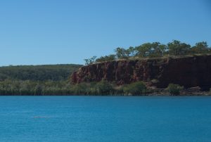
Our next destination was Raft Point, arriving midafternoon, the small cruise ship National Geographic Orion was anchored at the entrance to the bay. Lots of zodiacs taking passengers to the mangrove areas, which almost encapsulated the bay, and out to rocky islands to the west of the bay. Just as we were about to anchor, Sandra who was up front noticed a crocodile lurking near the mangroves on the south side of the bay, luckily the rubber zodiacs weren’t close, and neither were we thank goodness (Croc sighting #3). Peter wanted to anchor away from the mangroves and the cliffs, basically in the centre of the bay, but this area created difficulties and the anchor wouldn’t set due to the undulating seabed. So, we moved around the corner to Doubtful Bay – sheltered, peaceful and surrounded by majestic cliffs, just perfect! Photo below: passing amazing scenery as we make our way to Doubtful Bay.
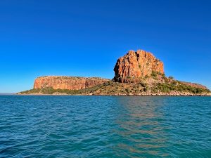
We were up as the sun’s morning glow appeared over the mainland, and made our way to Montgomery Islands, and particularly Montogomery Reef. We passed Steep Island, a massive sandstone structure, shaped like an uncut loaf of bread with rounded top. The sides were steep, deeply sliced (indented) and dropped vertically into the sea. Whilst a craggy outcrop with no name sat nearby. As we motored along, a passenger power cat named Reef Prince was behind us and gaining quickly, so as a courtesy Peter contacted the bridge via radio to clarify their intentions. Their plan was to head across our bow and anchor behind Kimberley Quest, another small passenger cruise ship anchored ahead. So, we slowed up to allow them to pass, eventually pulling up a short distance from their port hull. As we were prepping for our excursion to the reef, we were contacted via radio by a senior member of Reef Prince inviting us to join passengers and a guide on a two-hour reef tour (at no cost). Absolutely! Ten minutes later we were in a rib with five cruise passengers and Jackson, our guide and driver. Paul was in another rib with about twelve passengers, and Ruby had about eight in her rib. Photo of Steep Island below.
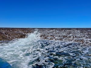
The tour was fabulous. Initially we made our way to Turtle Gully and yes we saw quite a few turtles as well as a small shark. Into the main channel where there were larger flows of sea water cascading over the terraces of coral. (It was a Neap tide, so as Jackson explained not as full on as during Spring tide, but we were able to get up much closer to the terraces and the action which wouldn’t occur in Springs). Further along we spotted Eastern Great Egrets; a couple of Grey Herons; more turtles; a super long cream coloured sea snake, and a huge blue stingray. After exiting the channel, we then returned to Sea Goddess. Next stop for an overnight stay and visits to two waterfalls was Red Cone Creek. Photos below: Coral terraces and ‘Sir Hiss’ the snake.
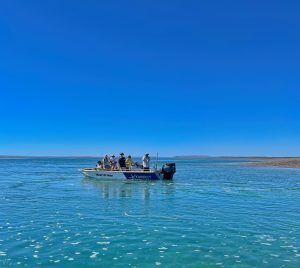
Red Cone Creek
We passed Raft Point, Steep Island and Doubtful Bay along the way. And wow this isn’t a creek it’s more like a huge river lined on either side by thick mangroves. The main lagoon section, broke off into two tributaries at the far end, likened to a ‘Y’ and even these were very wide. We anchored in the lagoon as the setting sun turned azure blue to yellow, orange and finally red hues; then the sky lit up with the most amazing display of stars.
Next day we whiled away the morning waiting for the tide to rise enough to take the dinghy to see the two waterfalls. Taking the left tributary you will reach Sapphire Falls, to the right Ruby Falls. Once the tide was right and with all our bits and pieces in the dinghy we headed off, firstly taking the tributary to the right for Ruby Falls. (Usually, we both sit on the outside tube of the dinghy but being croc safe, Sandra sat on the internal plastic seat while Peter brought along our large esky to use as a seat).
We coasted along keeping to the middle of the channel, avoiding the banks and shallows. Gradually the mangrove lined channel narrowed. Coming around a bend and there near the bank, with just the top of its head above water, was a croc (Croc sighting #4), we zipped passed it and continued. Further on we took a fairly sharp left turn into an even narrower channel with a mangrove growing in the water, plus a large fallen log. Together they were blocking half the channel which would require us to go closer to the bank. Sandra was scanning the bank when suddenly Peter depowered the dinghy and started to turn us around. Initially Sandra was confused, then Peter pointed to a large partially submerged crocodile i.e. we were so close we see the ridges on its back, and it was totally blocking the other half of the channel (Sighting #5). Peter got us out of there quick smart, and we headed straight back to the boat.
The plan to go to Sapphire Falls (taking the left tributary) was abandoned. A photo of a waterfall, that may or may not have water flowing, was not worth putting ourselves at risk of a possible croc attack. (Addendum: In hindsight we regret not trading in our current tender/dinghy for a metal one, which all the cruise ships use. We had discussed it when we were in Adelaide prepping for this trip but decided against it at that time. We would certainly recommend this to anyone considering a sailing trip to this part of the world).
Deception Bay
Up at 0430 for an 0500 start to Deception Bay. Thus far we have experienced relatively calm – slight sea conditions with wind force on the low side and the direction has been fickle. The current can also be advantageous while it’s with you, until it’s not. As a result, since leaving Broome, we have generally motor sailed with the headsail and/or mainsail out to catch whatever breeze we can. Even an extra half a knot can make a difference over a 10-hour sail. A massive difference from the turbulent conditions further south, thank goodness.
As we moved along, on the mainland tall craggy cliffs made way for softer, rolling hills. Via binoculars, Peter spotted a crocodile sunning itself on a beach near Freshwater Bay. A big one too, about 5 metres in length (Croc sighting #6). So many beautiful pristine beaches along the coastline, all deserted. Clearly, the ‘Be Croc Safe’ message is getting out – it’s not worth the risk. And even if you can’t see them, it doesn’t mean they are not there, patiently watching and waiting.
Purely a rest stop, we had a pleasant overnight stay at Deception Bay before moving on the next morning.
Sheep Island
Heading for another overnight stop at Sheep Island. Stunning scenery particularly at the south entrance to Camden Harbour on the mainland to starboard, Kannamatju Island to port. We passed Kuri Bay … where an active pearl farming operation was in place. While we were chugging along, a sea plane flew over, landed in the bay and made its way to a dock located close to buildings on the shore. We wondered if it was bringing in a customer or two.
As we moved on, we could see the McDonald Ranges in the distance, with a mesa Imorogu Tabletop and Mount Lookover both dominating at this point. We anchored in Brecknock Harbour on the southwest side of Sheep Island early afternoon.
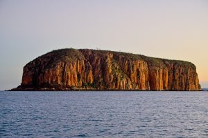
No sheep here in fact it is uninhabited, though once upon a time it was a farming community. Sandra became emotional when reading the history of the island. In particular, the story of Mary Pascoe who died here during childbirth in June 1865. (Conditions on the island would have been incredibly harsh at the best of times, and with no access to midwifery or medical expertise and support, childbirth complications would have been horrific for many). If reports are correct, her baby daughter died two months later. So incredibly sad. From our internet search we established that her grave, sitting alongside a boab tree, is well marked with a head stone though the inscription has weathered beyond recognition. The graves of others who died on the island are also there, but not at the same site. We had intended to visit the island and Mary’s grave; but unfortunately, not long after our arrival the wind picked up and choppy sea conditions negated a dinghy ride to the island. But as we motored passed the island and the boab tree the next morning, our thoughts were with Mary and her daughter. Sorry about the quality of the photo, its the best one we could get as we passed in the early morning sunrise. The outline of the boab tree in the foreground to the right of the photo below is the one referred to above.
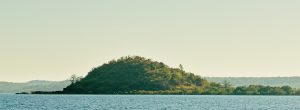
As we continued towards our destination, the Prince Regent River, rolling hills made way for heavily vegetated islands, islands with mesas, and/or craggy outcrops. Then onto Roger’s Strait between the mainland to starboard and a huge island called Augustus Island to port, surrounded by several smaller islands and islets. Large pearl farming operations on both sides of the Strait with lots of activity underway.
We crossed Hanover Bay to Unwins Island, lots of large exposed rocks within the Indian Ocean with at least a dozen or so close to shore, some perfectly round on top, like a bread roll, others craggy with vertical striations. Motored between Unwins and Mictyis Island. Rows and rows of horizontal and vertical ‘stone’ piled upon each other, some sitting quite precariously atop. They appeared ‘higgilty pigglty’, a jumbled mish mash of rocks that were somehow still able to create a wall or tower. Between the mainland and Unwins Island we were skating quite a bit due to the current and the presence of eddies scattered across the channel. ‘Whirlpool Point’ took this to a whole new level, lots of agitated water and swirling pools that Peter navigated with great care and precision. We continued to head down the channel towards our anchorage point, passing the eastern aspect of Midway Island. After some difficulty anchoring due to depth and an undulating seabed, we switched to the other side of the channel and anchored just southwest of Greville Island.
Our anchorage point was at the very top of the most northeast section of the Dambimangari Indigenous Protected Area (IPL) and the most northwest section of Prince Regent National Park. These two regions border each other until they reach their most southern corner, where the IPL land boundary turns and continues west, and the national park boundary turns and continues east.
Prince Regent River
The next morning, we upped anchor heading towards Prince Regent River and the Kings Cascade Falls and Cathedral Falls. Passing Marigui Promontory, then Saint Patrick Island followed by the larger Saint Andrew Island, both of which are heavily vegetated. (In our view, St Patrick Island may be smaller, but the topography is far more interesting and prettier). Between the islands, and in the distance a huge mesa sits atop a large hill on the mainland. From here we entered Saint George Basin, a huge body of water encircled by the mainland and split by the river. Peter spotted a croc in the middle of the Basin, heading across from St Andrew Island to the mainland (Croc sighting #7).
By 0830 with the current in our favour, thanks to Peter’s planning, we were making good time. And by 0850 we had reached the entrance to Prince Regent River where initially mangroves lined both banks. Then things started to get interesting, with heavily vegetated hills and cliffs to port whilst those to starboard were less so, scraggy trees and bushes on this side but the huge outcrops of naked rock were stunning. Another croc sighting in the river to starboard, eyes and back just visible above the water line (Croc sighting #8).
During our river passage this morning, a small old style power boat named Andante was in front of us. With the movement of the boat, sometimes on one side, sometimes the other, sometimes in the middle, Peter quickly caught on that the skipper knew the river well particularly from a depth perspective, so we followed. They were moving much faster than us, so we lost sight of them for a while. When we met up with them again, they had anchored. We had a quick chat over the side of each boat and Peter indicated we would anchor further on closer to the falls. But, after a short discussion between the two of us we didn’t venture much further before turning around to anchor behind them. Local knowledge is everything up here. So, we sat having dinner in the middle of the river watching the tide drop lower and lower until there was more mud flat than river in the channel. No crocs so that was a good thing.
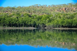
Peter was up during the night as the anchor ball (which together with the anchor light alerts other boaties that we are anchored) was banging around and about 4-5 large birds were trying to perch at the very top of the mast and spreaders. They were making a huge raucous, and did not like Peter disturbing them, but they eventually got the message. (We saw them the next morning and were able to identify them as eastern osprey).
Today is all about the falls. Moving easily along the river in the dinghy, we reached King Cascade Falls which were flowing and made a stunning picturesque scene. If you can imagine a tall, rock entrance at the opening to the river, which then made way for a horseshoe wall of rock about ¾ of the way around on either side then into mangroves. The falls flowed both centrally and slightly centre left. We had been following a small power boat to the falls, and as we arrived the guy called out that they had spotted a 3-metre crocodile in the mangroves on the left bank. We took the dinghy into the middle of the pool in front of the falls, we didn’t see the crocodile, but erring on the side of caution we took our photos and headed out.
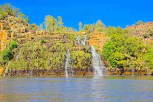
As we were leaving the tinnie from Andante arrived, they were planning to climb through the scrub to the top of the rock wall i.e. above the falls. We gave them a heads up re the crocodile, then left and made way further along the river to Cathedral Falls. Part way along our route Peter noted two huge splashes from the riverbank, one immediately after the other, too big to be fish or birds. Looking into the murky water. we couldn’t see anything, but Sandra was spooked. To reach the falls requires moving through a narrow creek, we were the only boat headed to that location at this time, all the other tenders in the river were metal, and given our croc experience at Red Cone Creek we decided to give this set of falls a miss.
We were so glad to spot Sea Goddess in the distance, and once back on board, we upped anchor and followed our track back to the river entrance. We made excellent time with the assistance of the current behind us, entering Saint George Basin around 1330. Then through the channel, returning to our previous anchorage spot for the night.
Next morning we were heading between the mainland and Greville Island. With a 3.6 knot current directly in front we were skating a bit, lots of turbulence and eddies particularly so through Whirlpool Point. Fish, large and small, jumping out of the water, birds circling overhead and diving down hoping to grab one for breakfast. Moving northward we were buzzed by low flying plane, and 45 minutes later we received a radio call from Border Force asking where we had come from and where we were heading, and our ETA for arrival in Darwin. No questions about who was onboard or any other details were required. Whenever we are underway, we always have AIS operational. (The automatic identification system, or AIS, transmits a ship’s position so that other ships are aware of its position, in order to avoid collisions. But it can be used by a myriad of authorities for other purposes).
By early afternoon we were motor sailing passed Cape Brewster, truly magnificent rock formations on the mainland; whilst to port there were a collection of low-lying islands one after the other – Glavert; Grey; Coronation; Gale; Mably; Fontanes Islands; Desaix Islands; Wickam, and Museums Island. We made way between the mainland and Glavert Island, anchoring in the gorgeous waters of Careening Bay around midafternoon.
Careening Bay*
Around 1945 we had just finished dinner when a large power boat arrived. It’s pitch-black outside and the boat is lit up like a Christmas tree, and by default so are we. Two tenders get loaded up with people who then proceed to the beach. With binoculars on we could see the handheld torches moving this way and that as they explored the scrub for about 20 minutes. Then back to the power boat, left about 45 minutes after their arrival and the last we saw of them they were motoring westward. Totally odd. We then spent the next half hour or so coming up with crazier and crazier scenarios of who they were and what they were doing. You have to get your entertainment somehow!
Up a bit later today at 0700, waiting for the tide to turn in our favour before moving on around 1100. In the meantime, Peter over to the beach on the mainland to a very special boab tree, ‘The Mermaid Tree’. The tree was inscribed by a carpenter on Phillip Parker King’s survey expedition in 1820. The expedition was tasked with accurately charting the Kimberley coast on the HMC Mermaid and HMC Bathurst. The tree has survived all that time, as has the inscription. It is National Heritage listed, but currently is not in good condition. So, we are really fortunate to have had this opportunity.
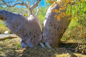
We got underway as scheduled, and five hours later we anchored for an overnight stop between the WA mainland and Tjungkurakutangari Island. (Don’t ask us how to pronounce that). Outcrops of lava like craggy structures randomly sitting in the sea just off the island shoreline; like something from the Star Wars or Mad Max movies. Rolling hills on the mainland moving round in an arc to large red ochre cliffs. As you can imaging sunsets here are spectacular.
Bigge Island
Our next overnight stop was Wary Bay, Bigge Island*. This is a huge drawcard for cruise ships and cruisers due to its famous indigenous rock art which is located in rock caves easily accessible from the beach. When we arrived the cruise ship Coral Geographer was already anchored, and as we drifted, we watched with interest as a series of tenders took passengers over to the island and escorted them up the beach. Which gives us a heads up on where we should land the dinghy tomorrow and we can also follow their tracks.
Heading into anchorage after the cruise ship left, we made our way closer to shore when Peter noticed a significant and sudden drop in depth. We carefully backed out and moved to anchor further offshore. Just as well we did, because at low tide that area became an above sea level reef. And we would have been sat atop it! Photo below shows the tidal range, here it’s low tide.
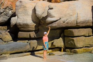
The bay itself is beautiful, surrounded on each side by magnificent stone cliffs. And we were treated once again to a spectacular sunset. But Mother Nature just keeps giving, around 1830 we saw the beginning of a soft creamy-pale yellow glow from the rising moon behind the island, and then the waxed moon itself rising quite briskly into the night sky, add in the super clear milky way and sparkling stars and it was just magical.
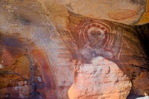
Fabulous start to the morning. As we took the dinghy to the beach we saw two large turtles, one heading out to sea and the other close to the rocky cliffs just after landing. Making our way towards the onshore rock caves, we discovered that the area is a turtle breeding site with three large, albeit empty, nests located quite closely together. Walking passed these, being careful not disturb anything we easily found the rock caves. There are three in total and initially we couldn’t locate any of the indigenous rock art that the caves are famous for. But we kept looking; then in the last cave we spotted our first painting, then another and another. At times we had to move quite deeply into each cave, squeezing through narrow passages or hunkering down to locate them. But when you found one or at times a cluster of paintings it was like finding gold. Just amazing. Unfortunately, some are now lost or obscured due to weathering, particularly those closest to the sea and/or cave entrances. But what we saw was super special. Equally special was an encounter with a white bellied sea eagle who flew very close to us, and at eye level, as we were standing near the water’s edge.
Wollaston Island
Indigenous rock art abounds throughout The Kimberley region, and we made way to another well-known location on the mainland near Wollaston Island*. Six hours later we were anchored between the island and the mainland.
We left Sea Goddess around 0900 the next morning and took the dinghy to the beach on the mainland (directly opposite our anchorage). The beach was surrounded on both sides by humungous rocks which encapsulated the small beach. Someone had created a shell collection on top of one of the rocks including two conch shells, and we wondered if this was a directional point or just a collection of shells. Lots of footprints leading to rocks, but there was no discernible pathway.
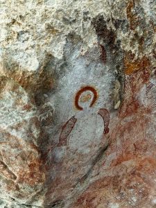
Peter went off to explore and found two caves at the top of the island, returning to let Sandra know he had found one site* (there are apparently several rock art sites in this area). We both climbed up the rocks then along a narrow track between two massive vertical rocks before reaching the top of the island where it flattened out to typical Aussie scrub (scraggy trees and bushes; tall grass; spinifex) … and a path that led to a large cave. Gorgeous rock paintings were located on sides of rocks, underneath rocks, on top of rocks, several were metres above ground level. Like Bigge Island, some were in better shape than others, and many were weathered but stunning, nonetheless. Underneath a massive rock was a circular space surrounded by smaller rocks which had the look and feel of a special place. So, we stayed on the edge not wanting to disturb anything and just let the atmosphere settle over us before returning to the dinghy and Sea Goddess.
Not long after our return we upped anchor and headed to another renowned rock painting site, Swift Bay, anchoring there by late afternoon.
Swift Bay
Next morning our anchorage neighbours stopped by in their dinghy and gave us some information and directions as to the best places to view the paintings. Based in Darwin they are regular visitors to this region. While we were chatting a large tawny nurse shark arrived, circled our boat and their dinghy. They told us that the shark is a regular visitor, mooching for food.
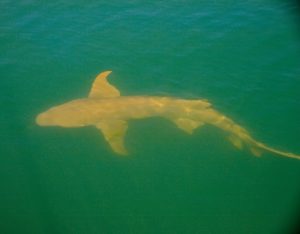
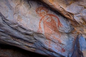
Around 1200, and with a good idea of where we were headed, we took the dinghy to the southern end of the bay. It was just off high tide, so some rock areas were exposed. We got the dinghy in as far as we could, Peter tying a line to a rock. Then we picked our way up, using the rocks as steps till we came to a gravel path in front of a massive rock. We were following the path in front of the rock, when Peter noticed the first rock painting, just beautiful.
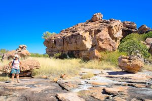
The path wound its way through long grass and more rocks, to another massive sandstone rock where more paintings were discernible, though there were a number that had weathered beyond recognition. Some were painted on rocks very close to the ground, and the person who painted these must have done so lying on his/her back. We had done our homework and knew that these areas are common burial sites, so we were careful not to move or displace anything. We took lots of photos before making our way back to the dinghy.
Once aboard Peter followed the coastline to another large section of rocks which hugged the water’s edge. There are known rock paintings here as well, and though we didn’t see any we used the GoPro to film the rocks* and there might be more to see here when we download the footage. Then it was a dinghy ride back to Sea Goddess for lunch and prepping for our overnight sail.
Vansittart Bay
First overnight sail in a while, heading to Vansittart Bay to see the DC3 (USAAC C-53), aircraft wreckage*. The wreckage has an interesting history as follows. In February 1942, during a flight from Perth to Broome to assist with the evacuation of Dutch citizens from Java, the pilot of the DC3 became disorientated. The plane veered off course and was forced to land on a saltpan on the Western Australian mainland near Vansittart Bay. All four crew members survived and were evacuated by sea plane.
We anchored in the bay around 1015, Peter had checked the wreck coordinates from the Uunguu Visitors Guide, so we had a good idea where to beach the dinghy. The visitor guide also directed us to a piece of pipe lodged on top of a sand dune, which was easily identifiable as we neared the beach. Once landed we checked the sand for any croc trails, then walked up the beach to a small sand dune via a well-used path (footprints everywhere). We passed the ‘pipe’ at the top then made our way down the other side to a saltwater lake that is walkable at low tide.
We were a bit nervous as we walked on the path to the lake, as it required us to walk through mangroves (a known croc hideout). Peter was carrying an oar from the dinghy, our only ‘weapon’, and keeping a close watch on either side of the path we got through okay. The visitor’s guide had also alerted us to the possibility of feral cattle on the lake that have been known to become aggressive and ‘charge’ at times. At this stage Sandra’s thinking, Jeez I hope this is worth it! Walking across the lake we could see the imprint of boots, sneakers and hooves!! As well as what looked like emu or crocodile prints (really hoping it’s emus). The closer we got to the middle of the lake the gooier it became which impeded our plan to walk briskly.
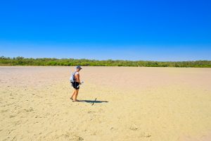
Once we reached the other side of the lake there were no markers or signage, just more mangroves and scrubby bushes and trees, discernible footprints went every which way. We took a gamble that the plane would be roughly in line with the pole on the other side of the lake. The first gap in the mangroves and scraggy bushes led nowhere, the next one we looked down Peter could see the plane a short distance away and we made a beeline for it.
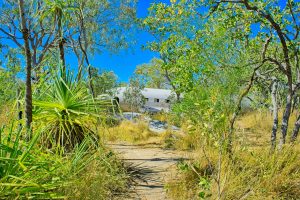
For its age the plane itself is in remarkedly good condition. The middle section of the fuselage had been removed which opened up the front and back sections of the plane. This allowed us to carefully step along narrow steel beams to the cockpit and the inner tail section (there was no floor or ceiling in place). One engine was still on site, as well as both wings and landing gear. As an added bonus we spotted a large, healthy boab tree nearby.
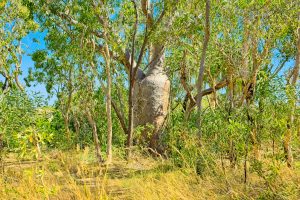
The plane was well worth the visit, and the journey to get here was something we will remember and talk about for a very long time. We made the return trip to the dinghy with no issues. After lunch aboard Sea Goddess, we departed Vansittart Bay for another overnight sail to Glycomis Bay. At 0300 hours we passed the most northern point of Western Australia. Big tick for achieving this milestone, Yeah!
Glycomis Bay
We anchored around 7-ish in the most stunning bay, once again lined with rock structures that rise out of the water’s edge and create a wall of patterns and colours. Reds, oranges, creams, browns, greys and black. Some with vegetation emerging from cracks. In other areas the rock structures are interspersed with trees and mangroves. It sounds random, and in one sense it is, but put it all together it creates the most amazing natural setting.
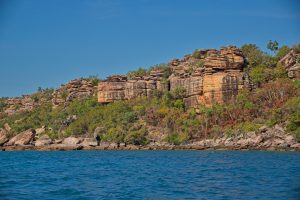
That afternoon we took the dinghy around the corner from our anchorage point to a narrow U shaped bay to see Glycomis Falls. This smaller bay is equally stunning with the surrounding cliff face reminding us of Indiana Jones movies. Unfortunately for us there was no water flowing, well there was a trickle. But you could certainly see from the discolouration of the rock where the falls would flow, and it would no doubt be a fantastic sight to see.
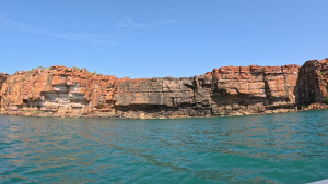
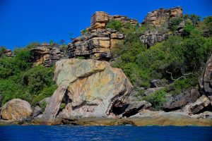
Exiting the falls area we headed back out into the main bay following the east – northeast coastline to the Lost City (photo below).
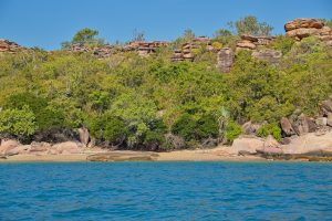
Amazing rock formations all along this strip with huge slabs of fallen rock at the water’s edge. Once upon a time people lived here. We didn’t walk up the hills to the ‘City’ as this would have required us to walk through dense mangroves and we were concerned about the possibility of crocs. So, we retraced our track back along the water’s edge to Sea Goddess. Then it was time to get prepped for an early sail tomorrow and our last few days in The Kimberley region.
*Each person will need to purchase a Uunguu Visitor Pass to access these islands/sites (currently $100.00pp). The Visitor Guide, available on the website, provides an overview of each major tourist attraction, directions and restrictions if applicable.
King George River & King George Falls
At 0430 we upped anchor at Glycomis Bay to ensure we reached King George River with the correct tide. We also had the benefit of a 1 knot current behind us, so we made good time arriving at Koolama Bay around 0730. We anchored for a short time while we waited for the depth of the river entrance to accommodate Sea Goddess’s draft (undercarriage) requirements plus some wriggle room. For the first time we would traverse a river up close and personal aboard Sea Goddess rather than the dinghy which made this excursion that much more special. We entered the river entrance at 0900, and just WOW-WOW-WOW we were immediately overwhelmed by the amazing scenery surrounding us on both sides. In his planning Peter had certainly saved the best till last.
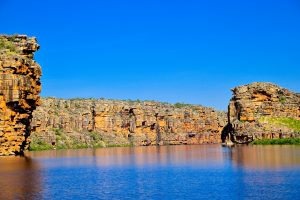
As we got closer to the falls the river narrowed to form a canyon with stunning cliffs towering over us on either side. Lots of ribs from a cruise ship passing by as they too headed for the falls.
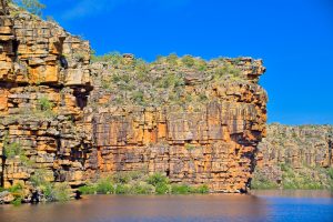
Once reached there are two falls, one on either side of a huge dividing wall of rock. Not a lot of water flowing, but enough to be impressed and get some great photos.
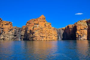
With a feel for the river’s turns and topography, we made our way back to the river entrance at a slow and steady pace which allowed us to soak in the majestic surroundings. It would also be our last day in The Kimberley region, so we wanted to make the most of these last few daylight hours and bank them in our memory. No doubt we will benefit from the large number of photos and video clips we have taken and stored over our time here.
We exited the river at 1220 and by 1300 we were anchored in Kooloma Bay in front of Lesueur Island for an overnight stay. To anyone reading this blog, we would highly recommend a trip to this part of Australia which is full to the brim with the most amazing scenery and experiences. Throughout our time in the region the weather has been glorious with lots of sunshine and cooler evenings and nights. There are several cruise ships which offer Darwin to Broome or Broome to Darwin trips. From three star to five star, they visit a number of the places we enjoyed, and no doubt other places that we missed. So do yourself a favour, grab a lottery ticket and if you win put a visit here high on your ‘Treat Myself’ list.
Darwin
At 0500 the next morning, Sunday 30th June, just as the glow of the sun started to appear over the horizon, we upped anchor at Koolama Bay bound for Darwin. Initially we headed across Joseph Bonaparte Gulf. Fickle winds kept us on our toes simultaneously managing a number of things with care – the wind changing direction and dropping in strength; sails; sea state; tides, current and fuel. It’s all part of the sailing journey. In the main, we have been very fortunate since leaving Broome not to have experienced the stormy conditions of the Southern Ocean and parts of the Indian Ocean. If anything, there has been little wind and seas have been relatively calm which has led to us relying on the engines a lot more and using more fuel than anticipated as we travel to our destinations. As a fuel saving measure we try as much as possible to alternate engines, and power up only to the required conditions.
The first night of our journey east, we were treated to bioluminescence which we haven’t seen in a while, off the rear of both port and starboard hulls. Bioluminescence is created by the production and emission of light by living organisms. As our boat glides over bioluminescence waters, the movement activates the glow of the organisms, creating a luminous path in its wake. Has a sparkle effect like small fairy lights of differing colours through the churning waters of the engines, just magical.
Early the next morning, Monday 1st July at 0610 hours we crossed the Western Australia-Northern Territory border. Not long after a pod of dolphins joined us at the bow, the first pod in a long while, a couple even breached. Obviously, a different species to others we have seen due to their colouring, snout shape and small size. As the day progressed and into the night, wind and sea conditions changed and we were a rocking and a rolling. Unpredicted changes in wind and sea state are not unexpected on a long passage such as this one. We motored through the night, Peter hand steering as our automatic steering and course navigation couldn’t cope with the conditions. Around 1145 the next day we changed course, and the wind and sea state settled a little but still choppy with a slammer every now and again.
Just before 1400 we could see Darwin on the horizon. Making our way to our anchorage we passed a mixture of watercraft including a number of cargo ships and tankers, a naval patrol boat and submarine, a port pilot boat, what we think was a huge cable laying vessel which we dubbed the Mean Green Machine due to its look and colour, as well as several small power boats and this was just in the waters surrounding Darwin. We cruised passed them all and arrived at our anchorage at Fannie Bay just before 1500 hours. Phew! We completed our post sail activities in record time then it was dinner; wine; shower, and bed.
Prior to arriving in Darwin we booked a berth at Cullen Bay Marina for a week. Accessing the marina required us to transit the Cullen Bay Lock. Peter had organised an 1100 timeslot with the Lockmaster via Channel 11 on the VHF radio. We upped anchor at Fannie Bay at 1030 making our way to the lock. When we arrived at the entrance there were two boats on the fuel-holding dock, a cat and a power boat, with another two smaller boats circling the holding bay. So, we turned around and headed back out again. After a short time, we saw the docked power boat leave so we assumed at least part of the holding dock would be free and headed back in. As we were approaching, we saw the Sealink Ferry powering down the channel, so Peter backed off to let them through first. (The ferries have a separate docking area so not an issue to let them go ahead).
Next minute two ribs come roaring passed us, one with lifeguards aboard and the other police who proceeded to pull up to the holding dock which doubles as a refuelling dock. Like the turtle and the hare, by the time we got through the entrance to the holding bay the lifeguard rib had moved on and the police rib was refuelling. Luckily there was enough room between the rib and the catamaran in front for us to dock. A lock operator came down to tell us that one of us needed to do an induction. So, Peter went with him, as one of us was required to stay with the boat at all times. Induction completed we waited.
Once we got the call up on the radio, we left the dock and slowly made out way forward between the lock walls. The lock is about 9.5 metres wide, Sea Goddess is 7.8 metres wide, so it was very squeezy. Once we got through the lock gates Sandra got the stern slip line around the uprights of a steel ladder bolted to the lock wall and held on to the free end keeping Sea Goddess in place. Peter put the bow slip line around a pole and again held on to this. As the water rose in the lock, we were required to slowly pull the line in, all the while the lockmaster with the handheld lock remote control was watching from above. Once the water was at the right depth, we made our way through the lock gates at the other end and headed to our berth.
Once berthed and our post sail activities completed, we headed out for something to eat, to introduce ourselves at the marina office and have a look around our immediate environment. Marinas attract a range of eateries and businesses which overlook the berth area, and here was no different. Café, ice creamery, Greek and Indian restaurant and a quirky bar-bistro called Lolas Pergola. Quirky is good, so we stopped in for Sangria and pizza. Met the owners who were super friendly and joined us for a little while.
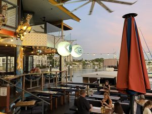
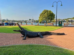
Though seriously hot and humid, we enjoyed our time in Darwin getting out and about on the ebikes; catching the bus here and there (while we were there a three month trial of free public transport for everyone was underway); chatting with other boaties including the guys from Border Force who were docked a couple of boats down from us.
Peter also spent some time working out options for the trip to Cairns, and in particular tides. Whilst factoring in our marina departure time by midday on Wednesday.
Option A: Up super early on Wednesday morning to be at lock for 0600.
Option B: Leave berth around midafternoon on Tuesday for a 3pm lock time and stay overnight at anchor in Fannie Bay. We would then leave a little later on Wednesday morning to address the tide issue.
We opted for B even though we’ve paid for the berth till Wednesday midday, Sandra wasn’t keen to go through the narrow lock in darkness/semi darkness.
We traversed the lock on time with no issues and made our way to the fuel dock. Cost of diesel $1.95/litre which was half the price of Dog Leg Creek so we were cheering. Our overnight stay at Fannie Bay was comfortable and at 0700 the next day, 10th July, we upped anchor for Cairns. Queensland here we come!
Thank you so much for taking the time to read our blog, we hope you enjoyed it. Till next time take care everyone xx
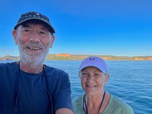
For ease of location we have grouped all the anchorages we utilised for the Broome to Darwin leg into one blog. Refer below or click this link https://seagoddessadventures.com/broome-to-darwin-anchorages/
For our review of Cullen Bay Marina please click here https://seagoddessadventures.com/cullen-bay-marina/
